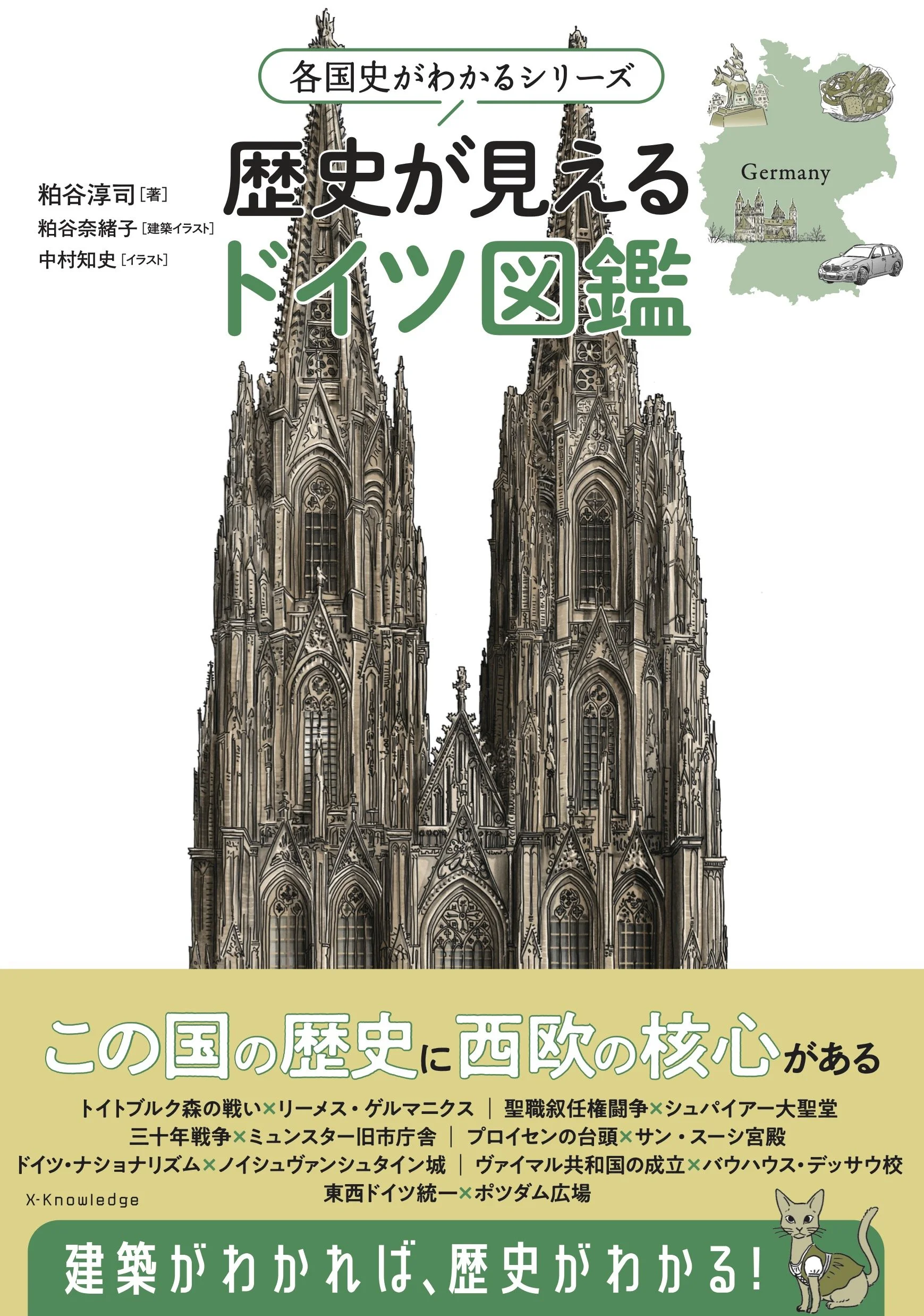
歴史が見えるドイツ図鑑
2022年のドイツ長期滞在をもとに執筆した書籍。エクスナレッジ社による「建築を通して歴史を語る」という新しい形式の歴史書シリーズの一冊であり、イギリス、フィンランドに続く第三弾として刊行された。粕谷淳司が文章執筆を、粕谷奈緒子が建築イラストを、それぞれ担当している。
KAOにとってこれは、建築作品とは異なるかたちで世に出た初めてのプロジェクトである。しかし同時に、本書は単なる歴史書ではなく、建築と都市を手がかりとして歴史を読み解くために構成された一つの「空間」でもある。時間の層を横断しながら歴史を組み立てていくその構成は、私たちにとって、建築の設計と同じ思考の延長線上にある。
ヨーロッパの建築や都市を考えるとき、「ドイツ的なるもの」はしばしば捉えにくい存在として感じられる。それはなぜか。本書はこの問いを出発点とし、古代ローマ時代から第二次世界大戦後に至るまで、ドイツ地域の建築と都市の変遷をたどることで、その輪郭を浮かび上がらせようとした。
中世から前近代にかけてのおよそ1000年のあいだ、ドイツは「神聖ローマ帝国」として、西欧キリスト教世界の形式的中心に位置づけられていた。本書では、その長い歴史を建築と都市の視点から読み直し、ドイツ史を四章に分けて記述している。さらに、歴史を別の角度から照らし出す「ブリッジコラム」を挿入し、以下の問いを通してドイツの歴史像を立体的に読み解いた。
・ドイツは、いつ「国」になったのか?
・なぜこの本ではプラハを扱うのか?
・宗教改革がつくった、見えない国境線
・三十年戦争――ドイツが経験した「世界の終わり」
・ベートーヴェンは、なぜ征服者ナポレオンを「英雄」と呼んだのか
・ナチス・ドイツは、ドイツ史の中でどのように位置づけられるのか
・エルベ川から読み解くドイツ
また、本書のもう一つの特徴として「地図で読むドイツのかたち」と題した連続地図を制作したことが挙げられる。フランク王国から第二次世界大戦後の東西ドイツ分断期に至るまで、同一範囲・同一スケールで描かれた地図を並置することで、ドイツという地域のかたちが歴史の中でどのように変化してきたのかを視覚的に読み取ることができる。
建築や都市がそうであるように、歴史もまた時間の中で層をなしながら積み重なっていく。本書は、その層を建築的に読み解き、再構成することによって、「ドイツという場所」の姿を描き出そうとした試みである。
名称:歴史が見えるドイツ図鑑(書籍)
著者:粕谷淳司
建築イラスト:粕谷奈緒子
イラスト:中村知史
カバーイラスト着彩:Miltata
デザイン・DTP:鈴木徹(THROB)
地図トレース(p.190–193):加藤陽平
印刷:シナノ書籍印刷
出版社:株式会社エクスナレッジ
発売日:2026年4月1日
言語:日本語
ページ数:208
A Visual Atlas of German History through Architecture
This book was written based on a long-term stay in Germany in 2022. It is part of a new series published by X-Knowledge that explores history through architecture. Following volumes on Britain and Finland, this book constitutes the third installment of the series. Atsushi Kasuya authored the text, while Naoko Kasuya created the architectural illustrations.
For KAO, this project represents the first work presented to the public in a form other than a built architectural project. At the same time, the book is not merely a work of historical writing. Rather, it can be understood as a constructed “space” through which history is read and interpreted via architecture and cities. The structure of the book—traversing layers of time and assembling historical narratives—emerges from a mode of thinking closely related to the design of architecture.
When considering European architecture and cities, the notion of “the German” often appears elusive. Why is this so?
This book begins with that question and traces the transformations of architecture and cities in the German lands from the Roman era to the period following the Second World War, in an attempt to reveal the historical formation of this cultural landscape.
For roughly a thousand years from the Middle Ages to the early modern period, the German lands existed within the framework of the Holy Roman Empire, formally positioned at the center of the Western Christian world. Revisiting this long history through the lens of architecture and urban form, the book presents German history in four chapters. In addition, a series of “Bridge Columns” offers alternative perspectives that illuminate key questions within the historical narrative:
• When did Germany become a “nation”?
• Why does this book discuss Prague?
• Invisible borders created by the Reformation
• The Thirty Years’ War: Germany’s “end of the world”
• Why did Beethoven call the conqueror Napoleon a “hero”?
• How should Nazi Germany be positioned within German history?
• Reading Germany through the Elbe River
Another distinctive feature of the book is the section titled “The Shape of Germany through Maps.” A sequence of maps—drawn at the same scale and covering the same geographical range—traces the changing territorial configuration of Germany and its neighboring regions from the Frankish Empire to the divided Germany of the post–World War II era. Through their visual continuity, these maps reveal how the spatial structure of the German lands has evolved over time.
Just as architecture and cities accumulate layers through time, history itself is formed through successive strata. This book attempts to read and reconstruct those layers in architectural terms, offering a way to perceive the historical formation of “Germany as a place.”
Title: A Visual Atlas of German History through Architecture (Book)
Author: Atsushi Kasuya
Architectural Illustrations: Naoko Kasuya
Illustrations: Tomofumi Nakamura
Cover Illustration Coloring: Miltata
Design & DTP: Toru Suzuki (THROB)
Map Tracing (pp.190–193): Yohei Kato
Printing: Shinano Shoseki Printing Co., Ltd.
Publisher: X-Knowledge Co., Ltd.
Release Date: April 1, 2026
Language: Japanese
Pages: 208